Interactive Map[]
Click here to be redirected to the interactive map
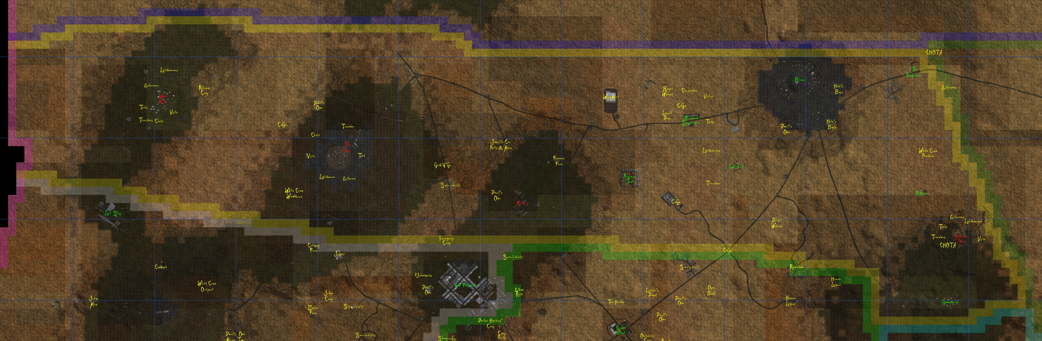
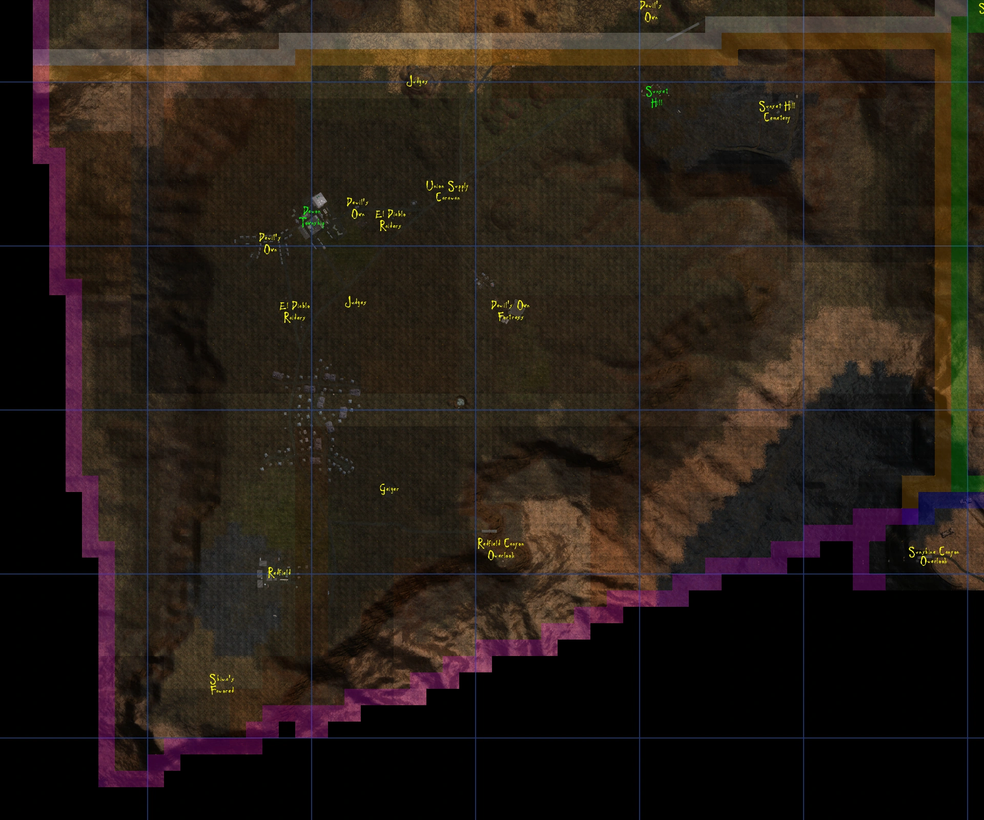
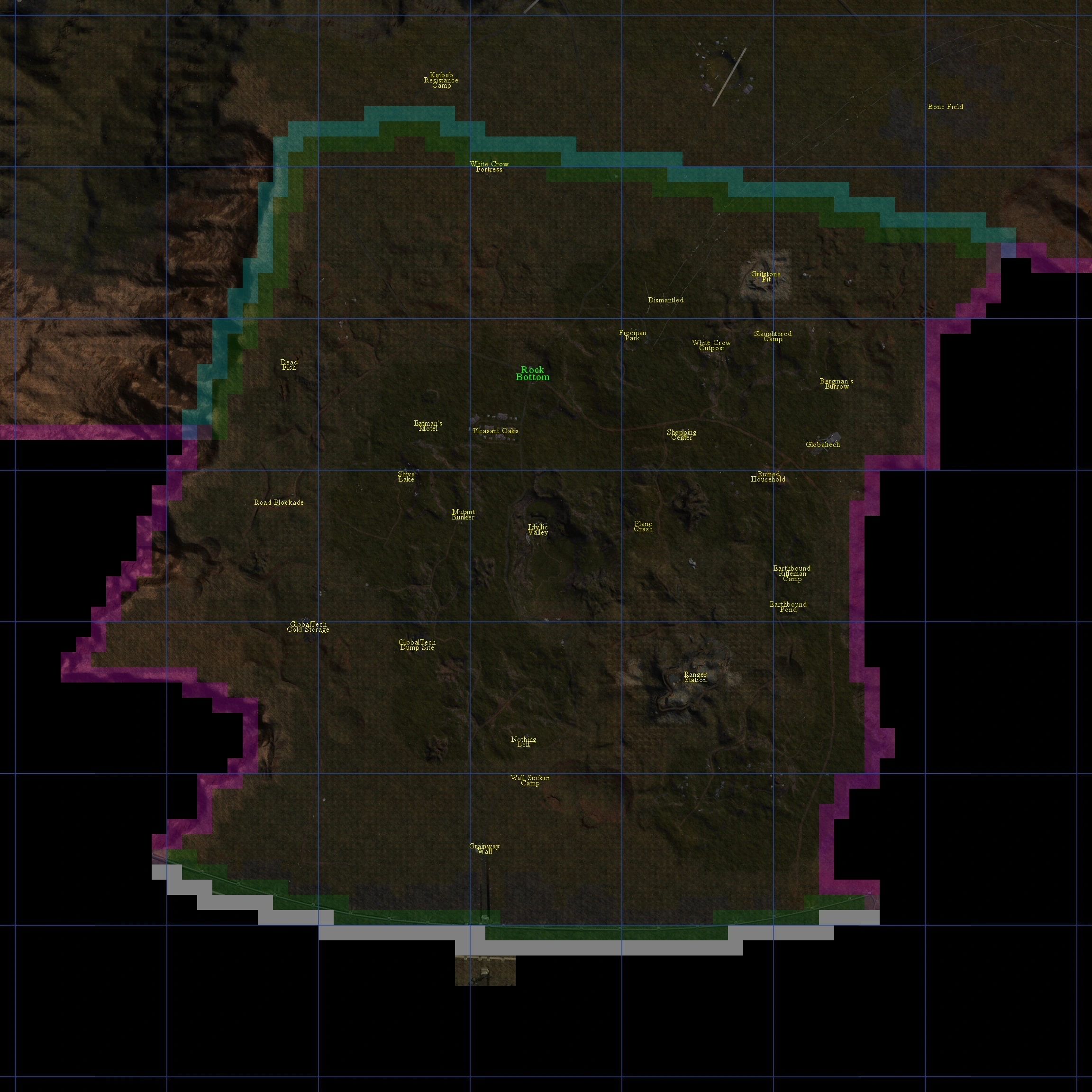
Plateau - Sector 1[]
- In-World Map
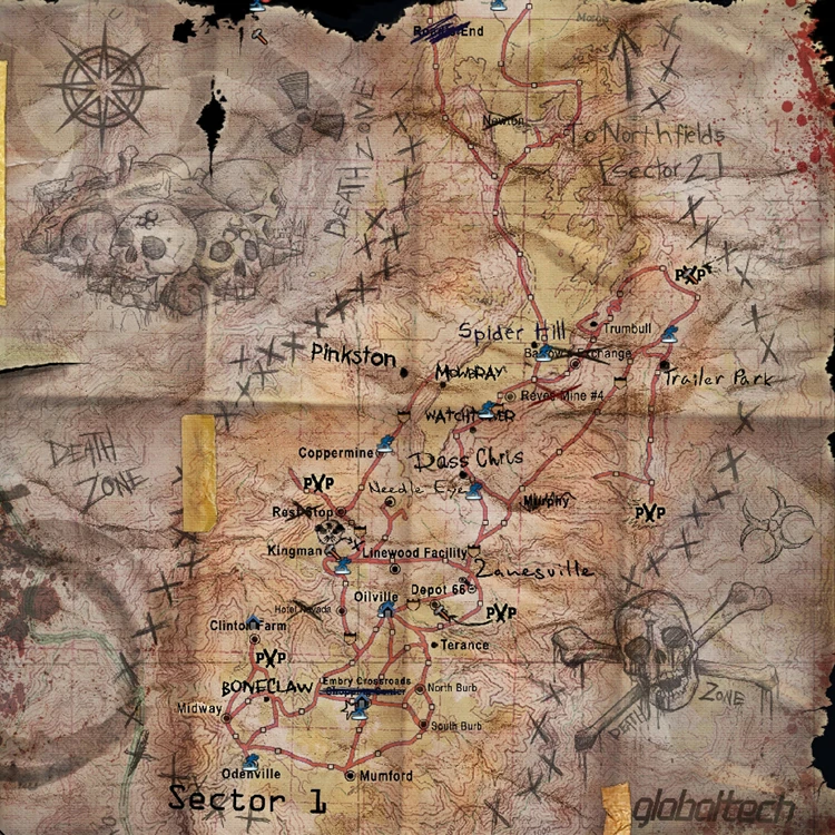
- Sector Map
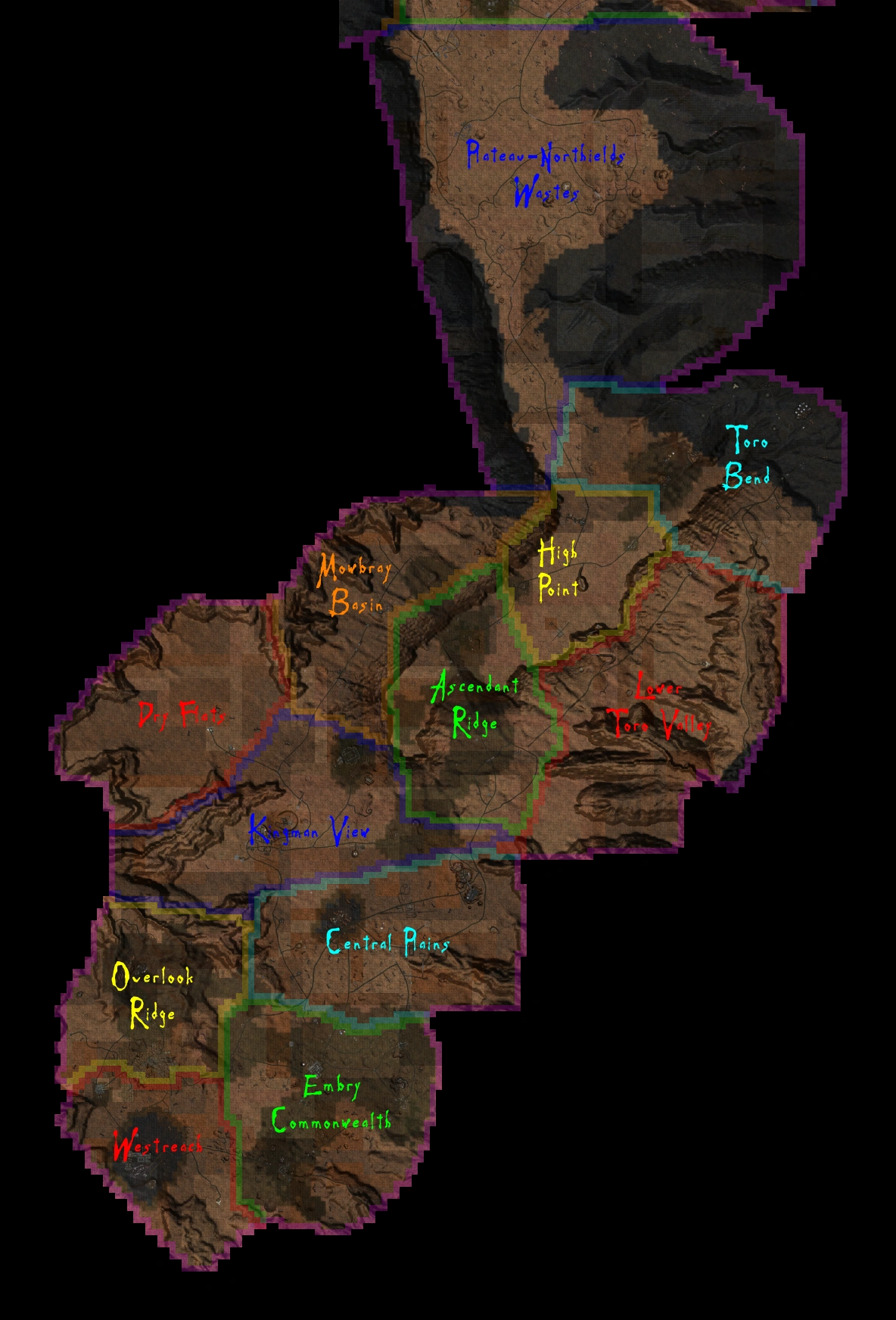
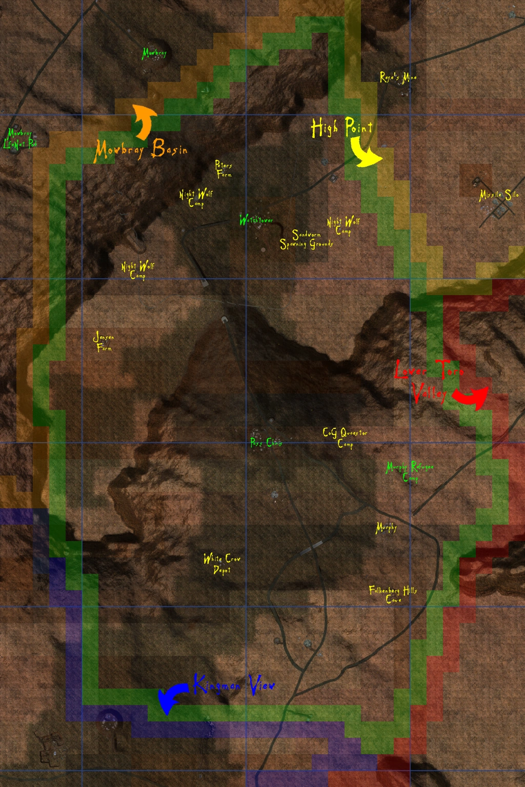
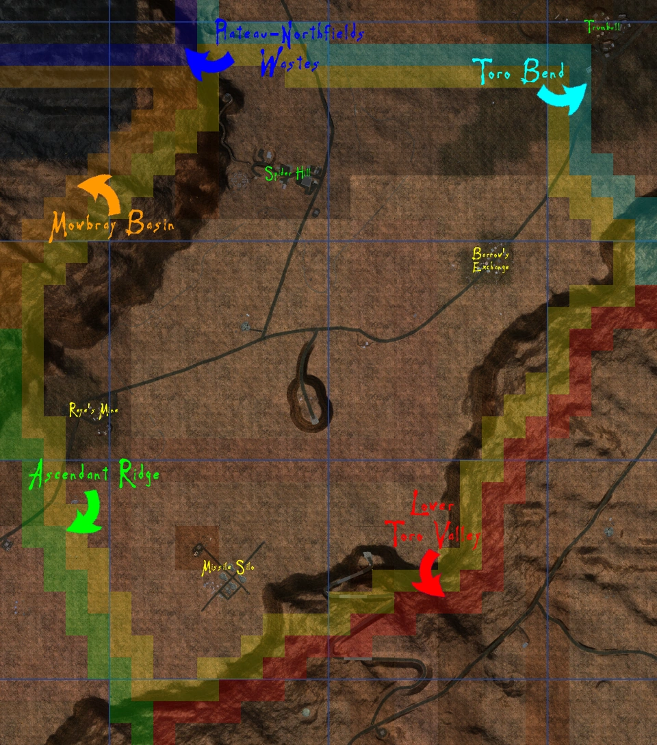
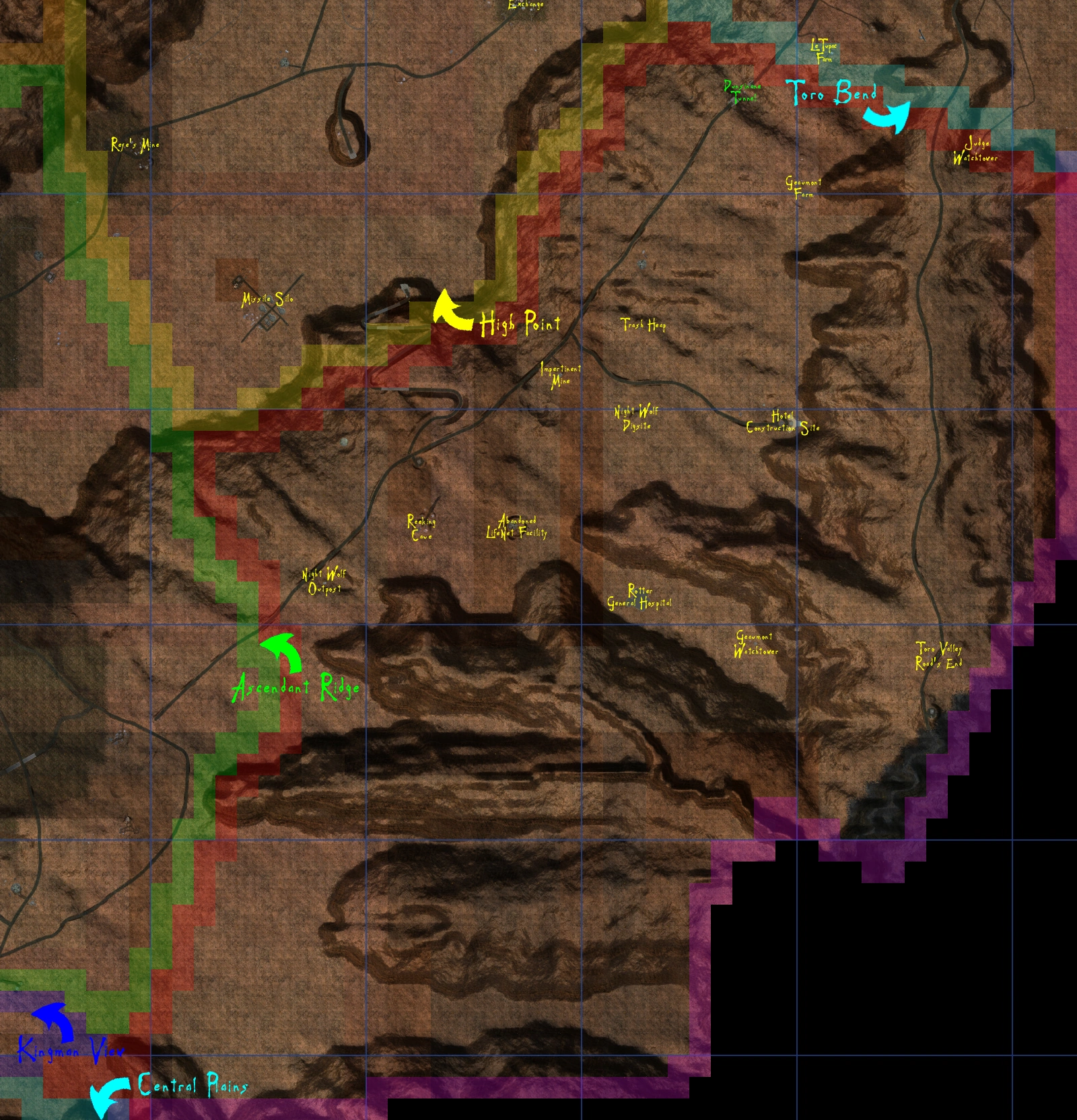
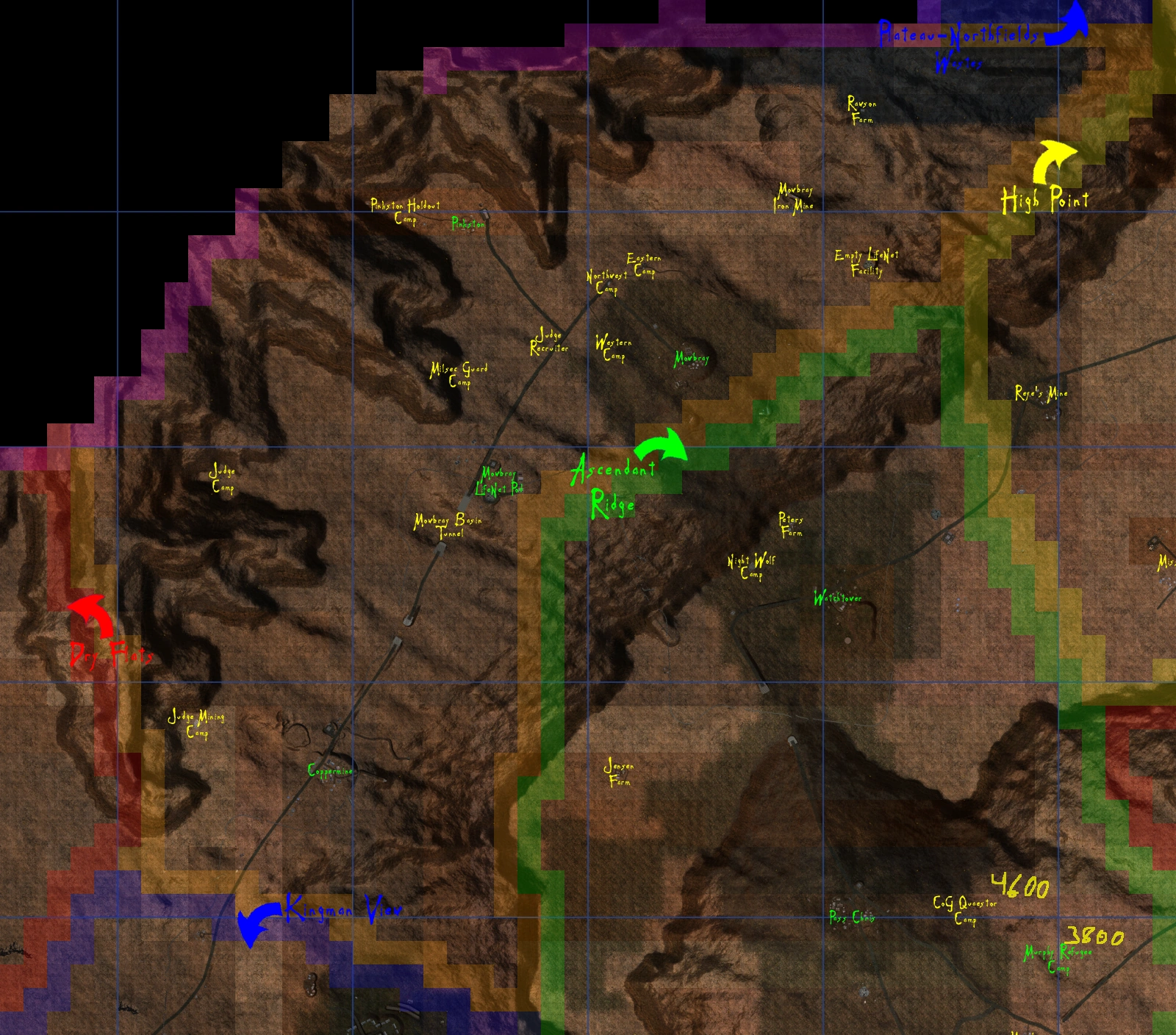
Ascendant Ridge[]
- County Map
Central Plains[]
- County Map
Dry Flats[]
- County Map
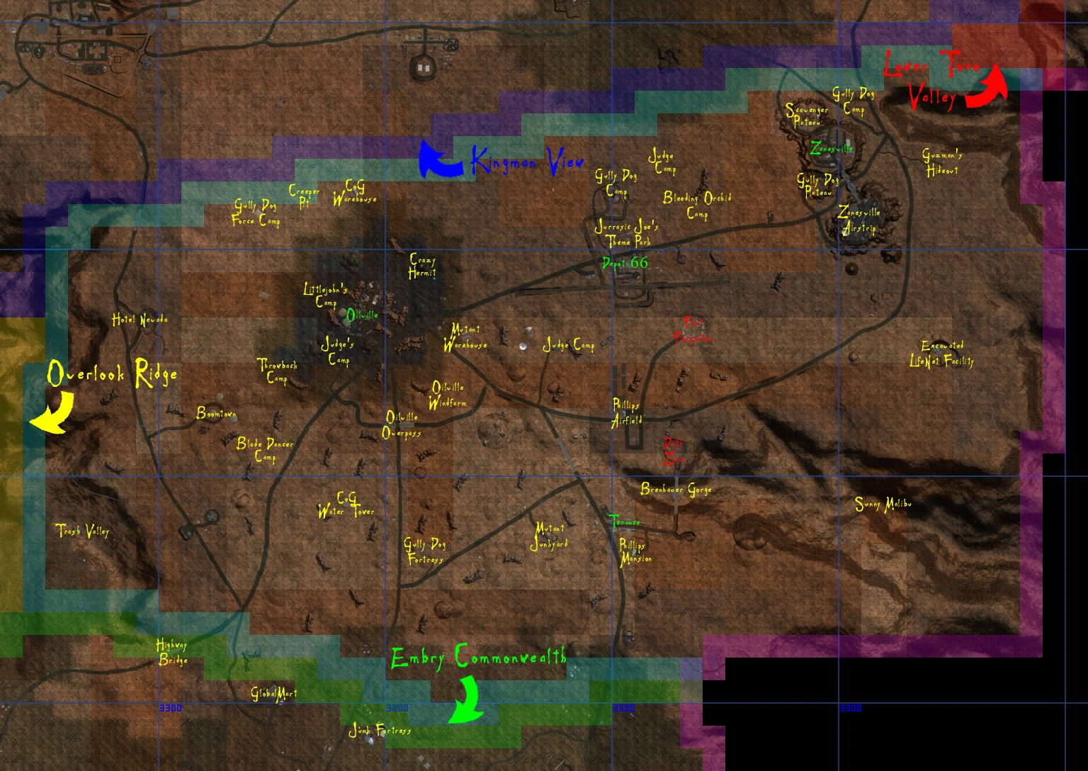
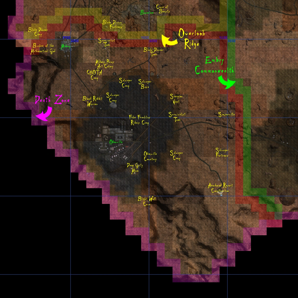
Embry Commonwealth[]
- County Map

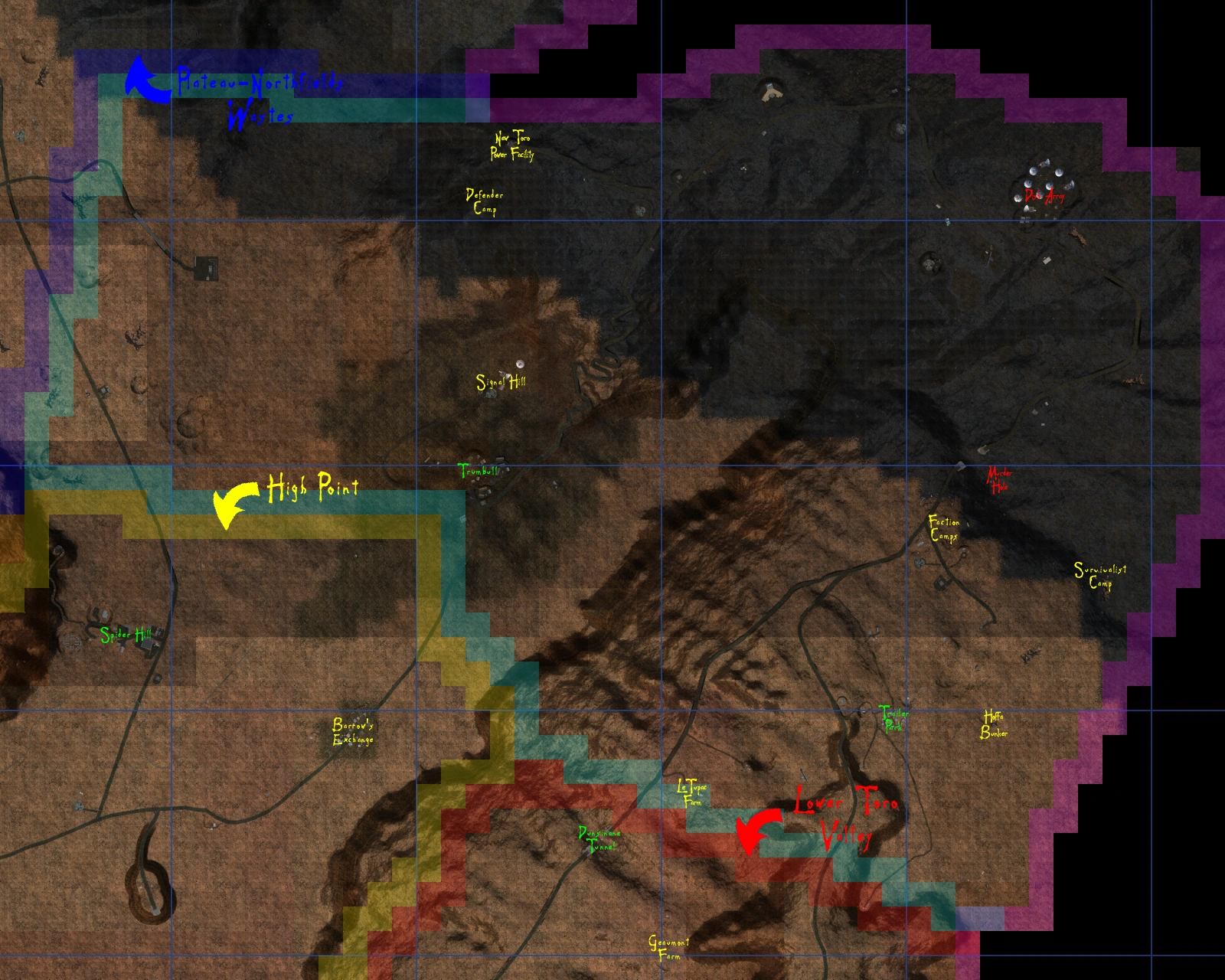
High Point[]
- County Map
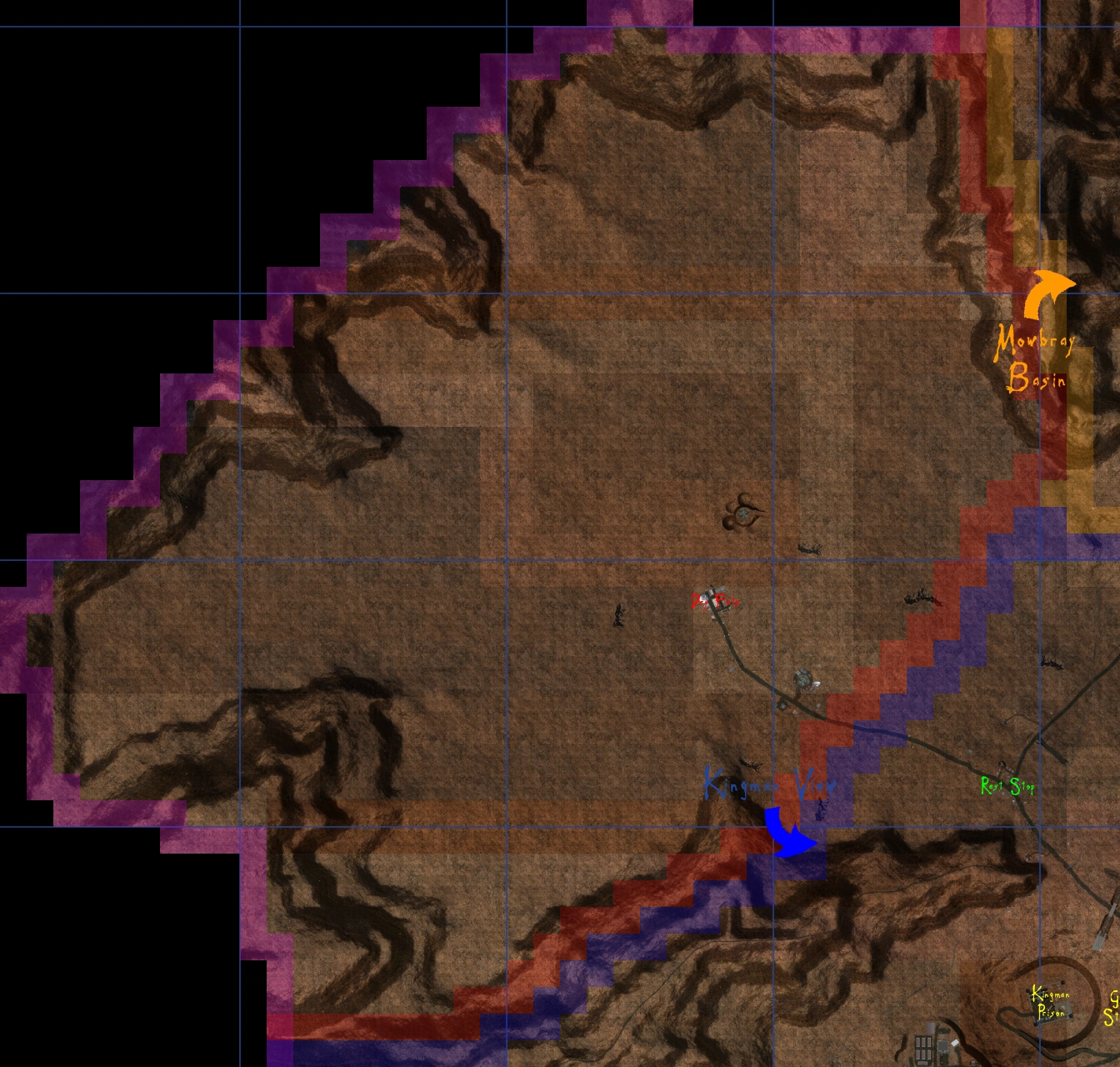
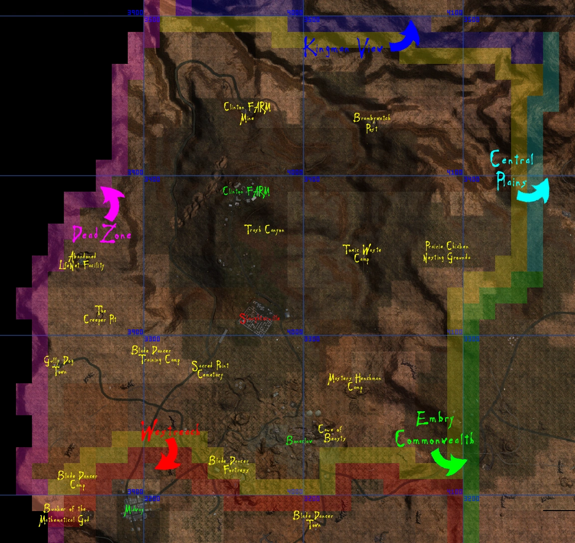
Kingman View[]
- County Map
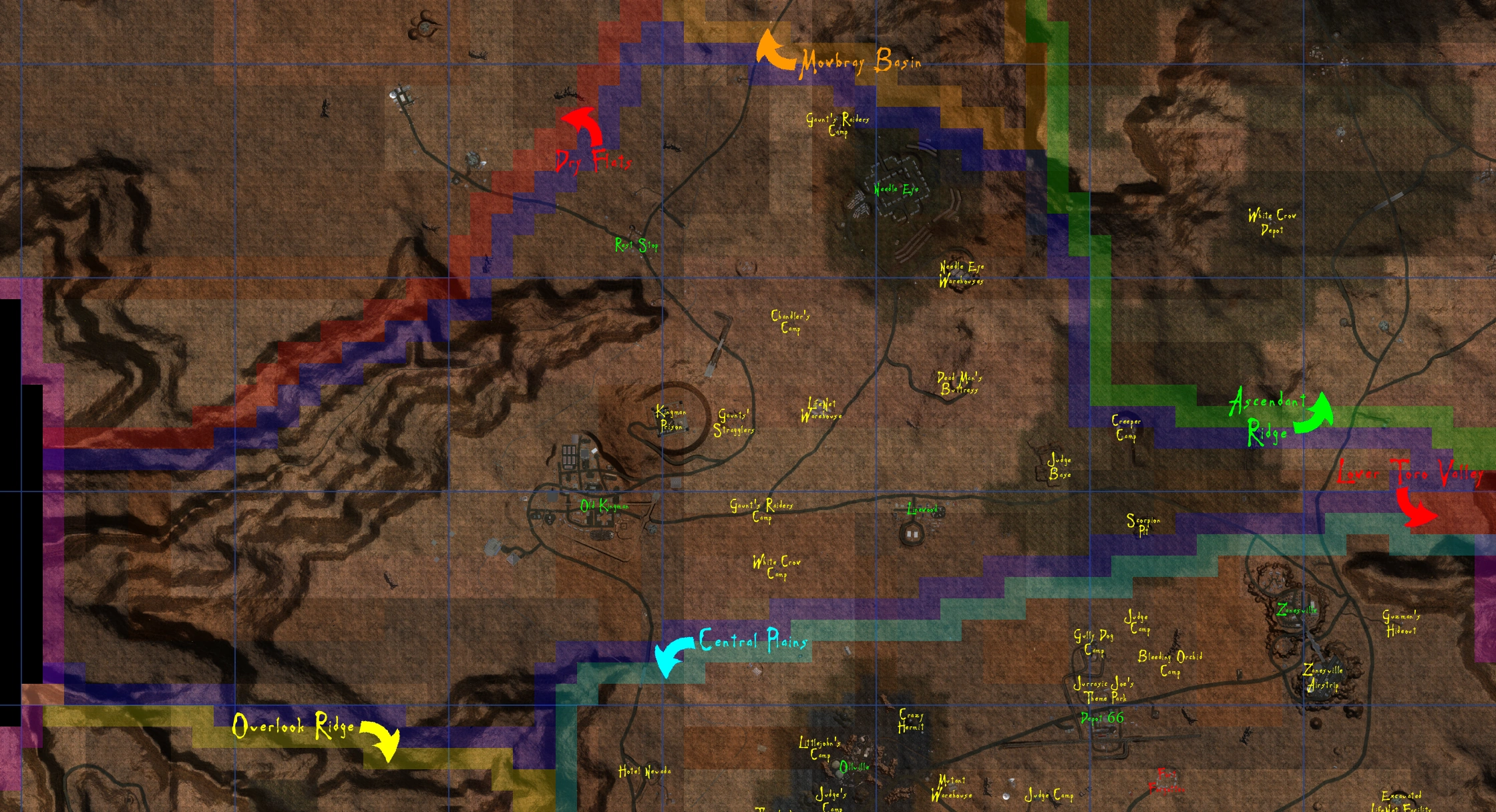
Lower Toro Valley[]
- County Map
Mowbray Basin[]
- County Map
Overlook Ridge[]
- County Map
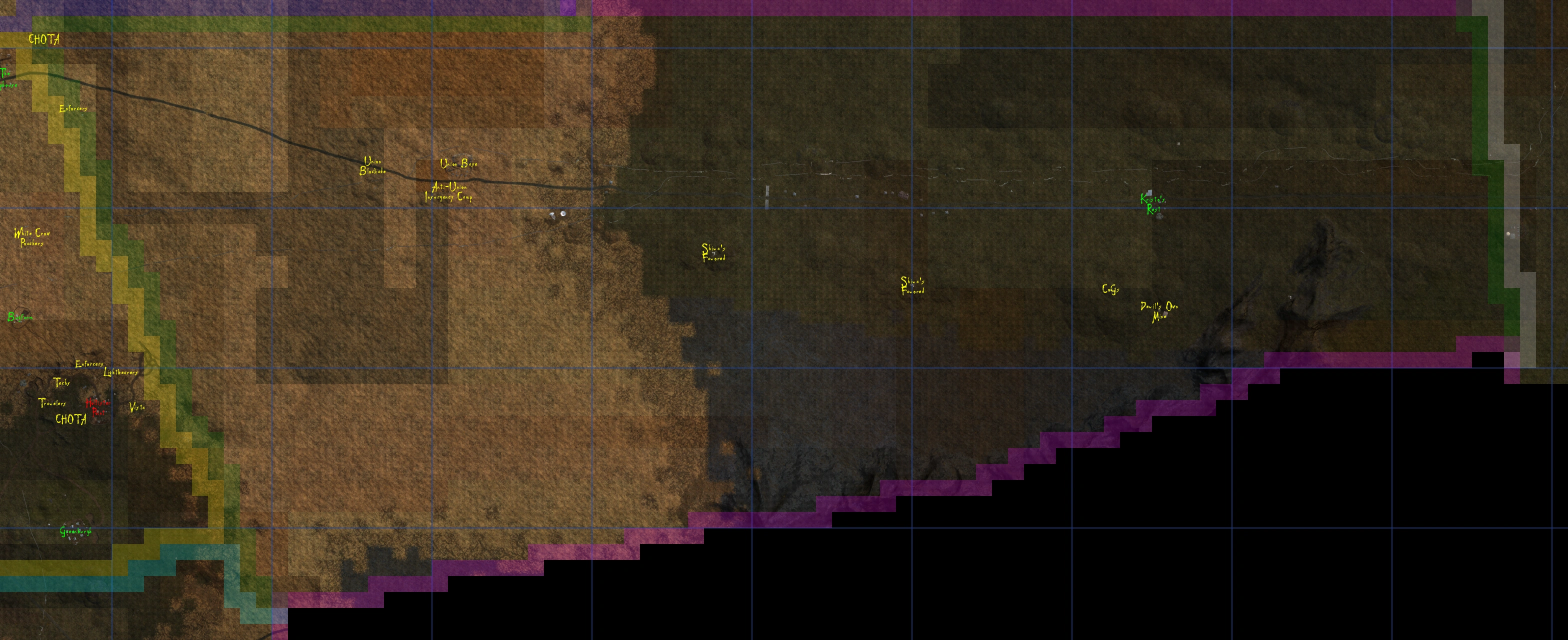
Plateau-Northfields Wastes[]
- County Map
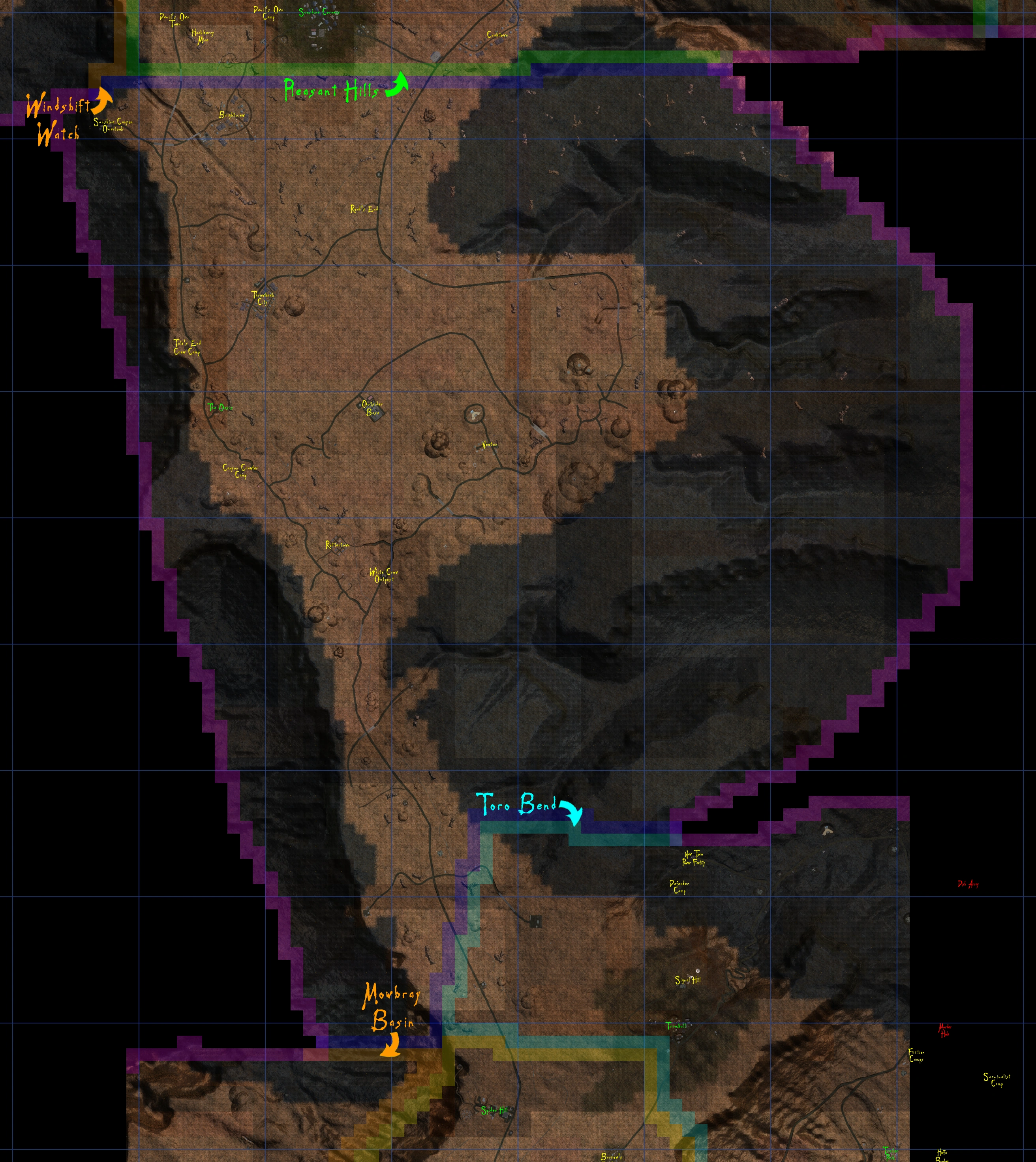
Toro Bend[]
- County Map
Westreach[]
- County Map
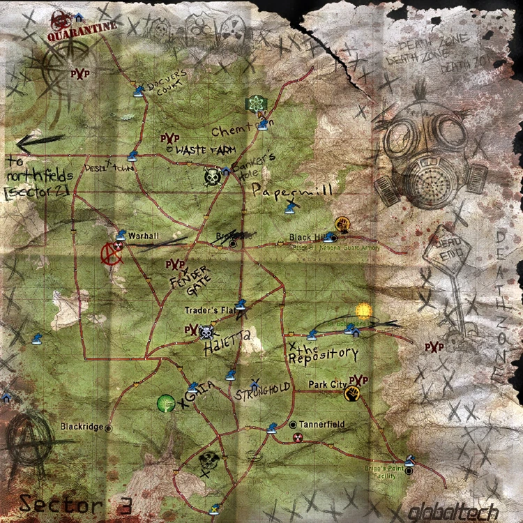
Northfields - Sector 2[]
- In-World Map
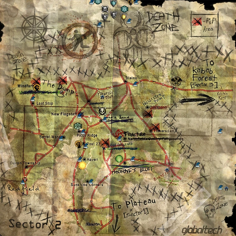
- Sector Map
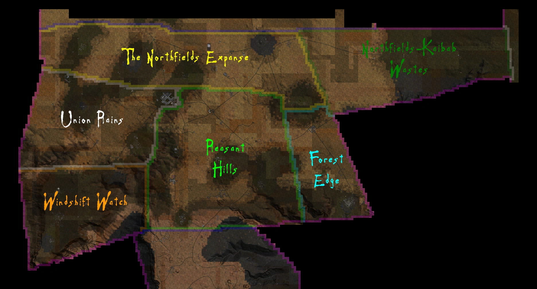
Forest Edge[]
- County Map
The Northfields Expanse[]
- County Map
Northfields-Kaibab Wastes[]
- Country Map
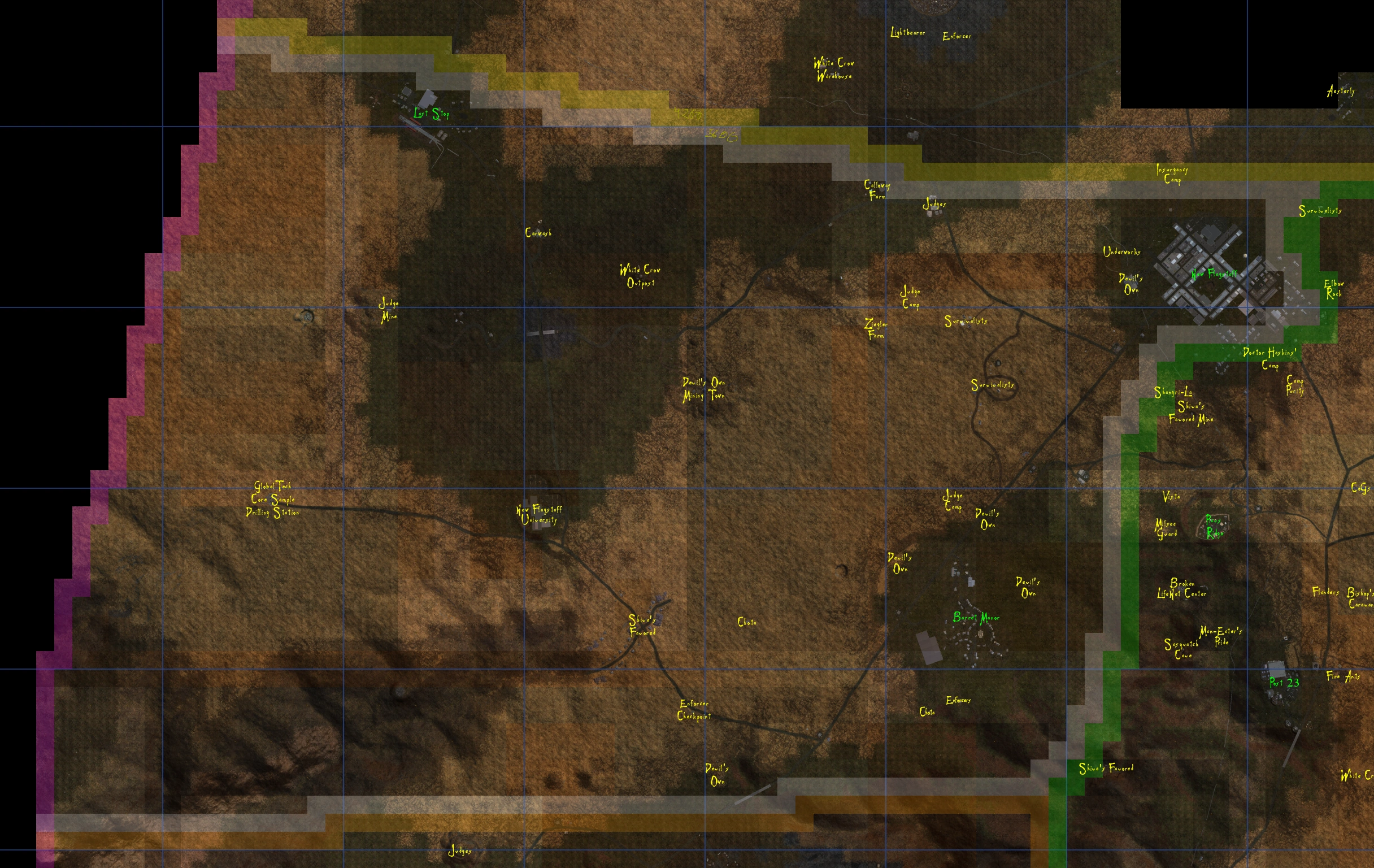
Pleasant Hills[]
- County Map
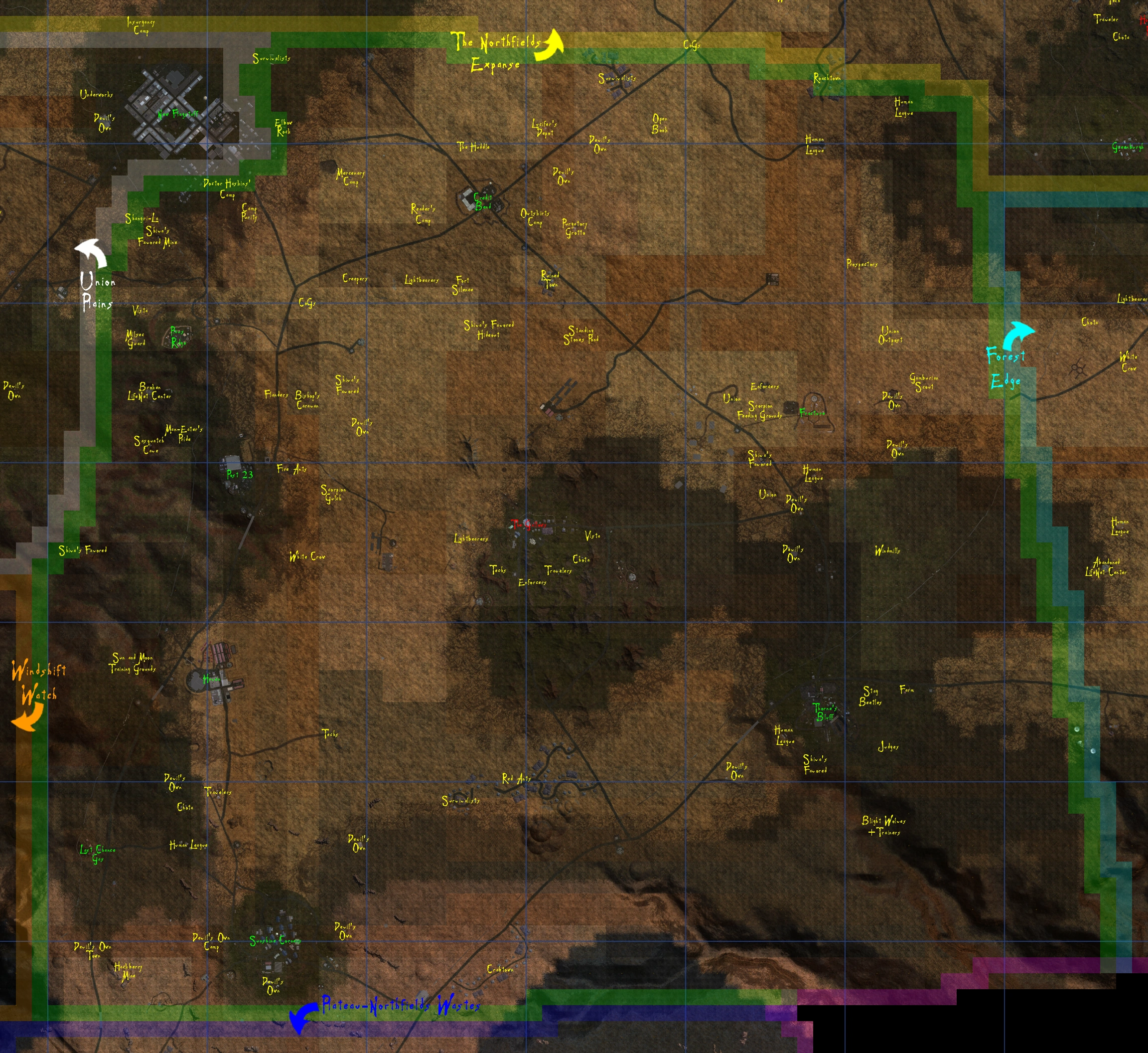
Union Plains[]
- County Map
Windshift Watch[]
- County Map
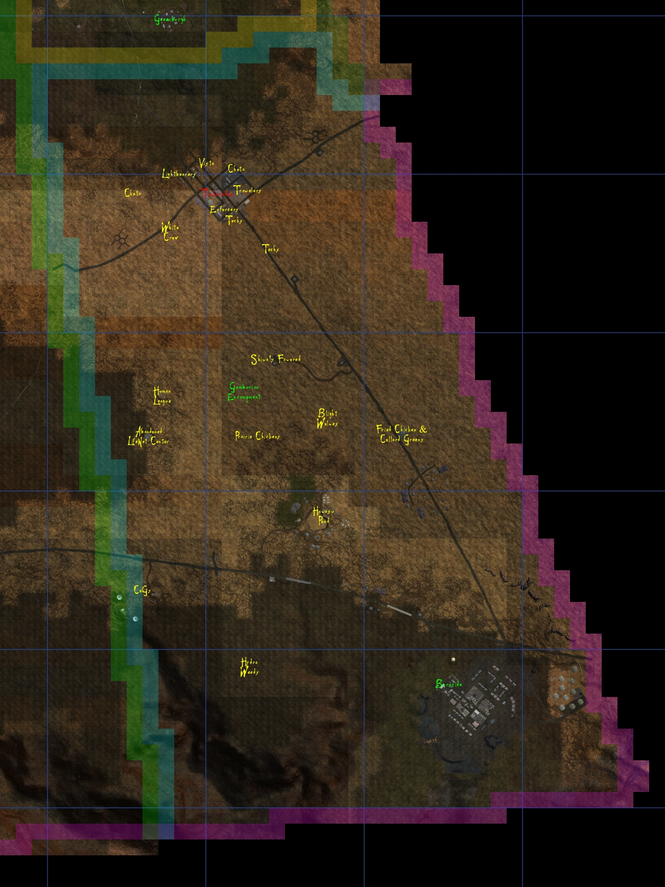
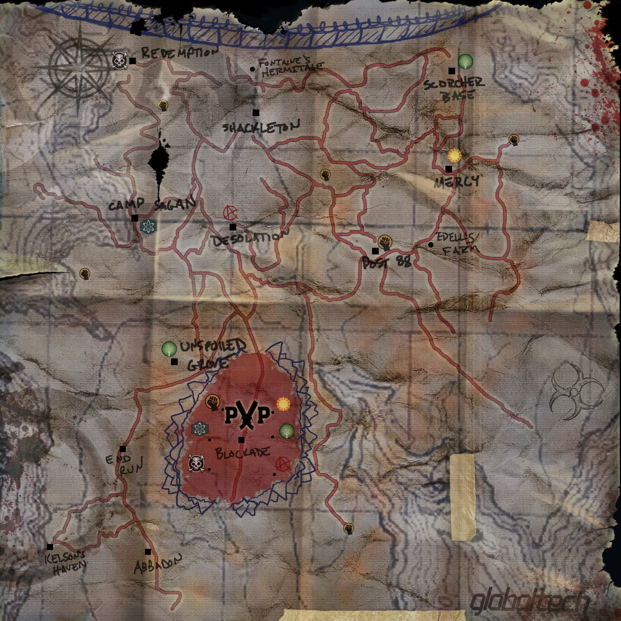
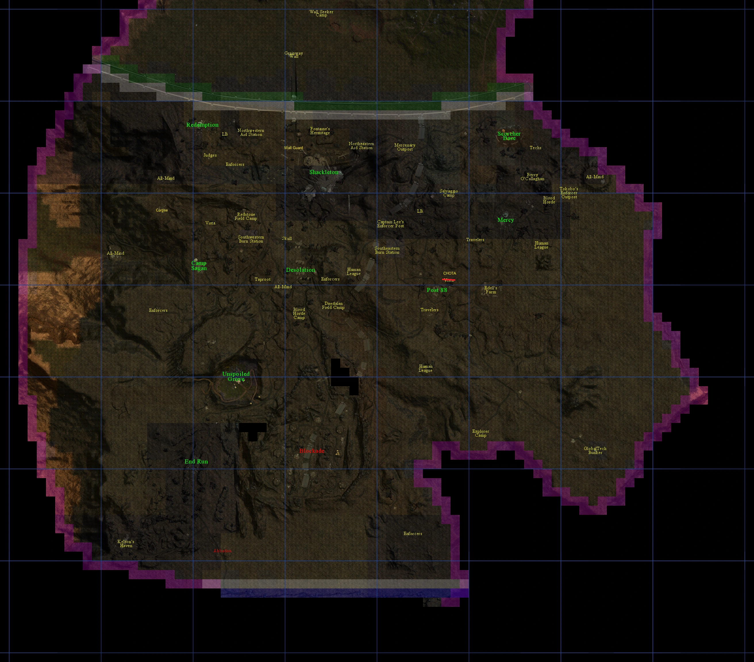
The District[]
For more info see The District.
- The The District Map
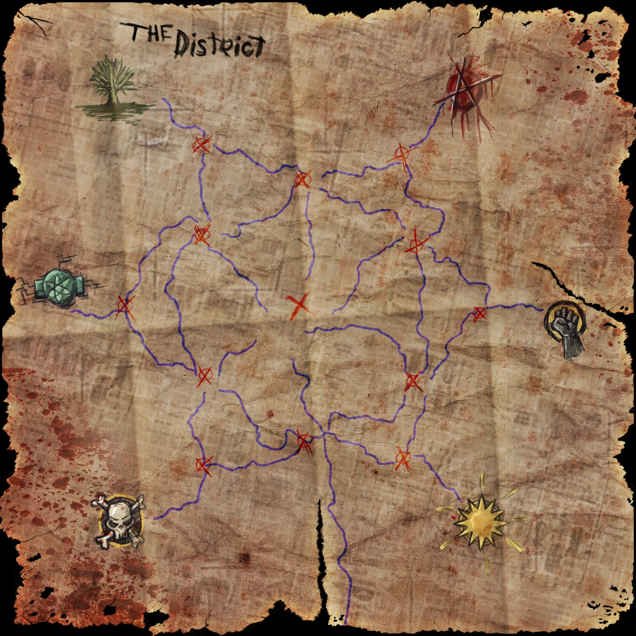
- The The District Map with the Keeps numbered.
- [[File:Territory_Control_Map_Numbered.jpg|150px|The [[The District] map with numbered keeps.]]
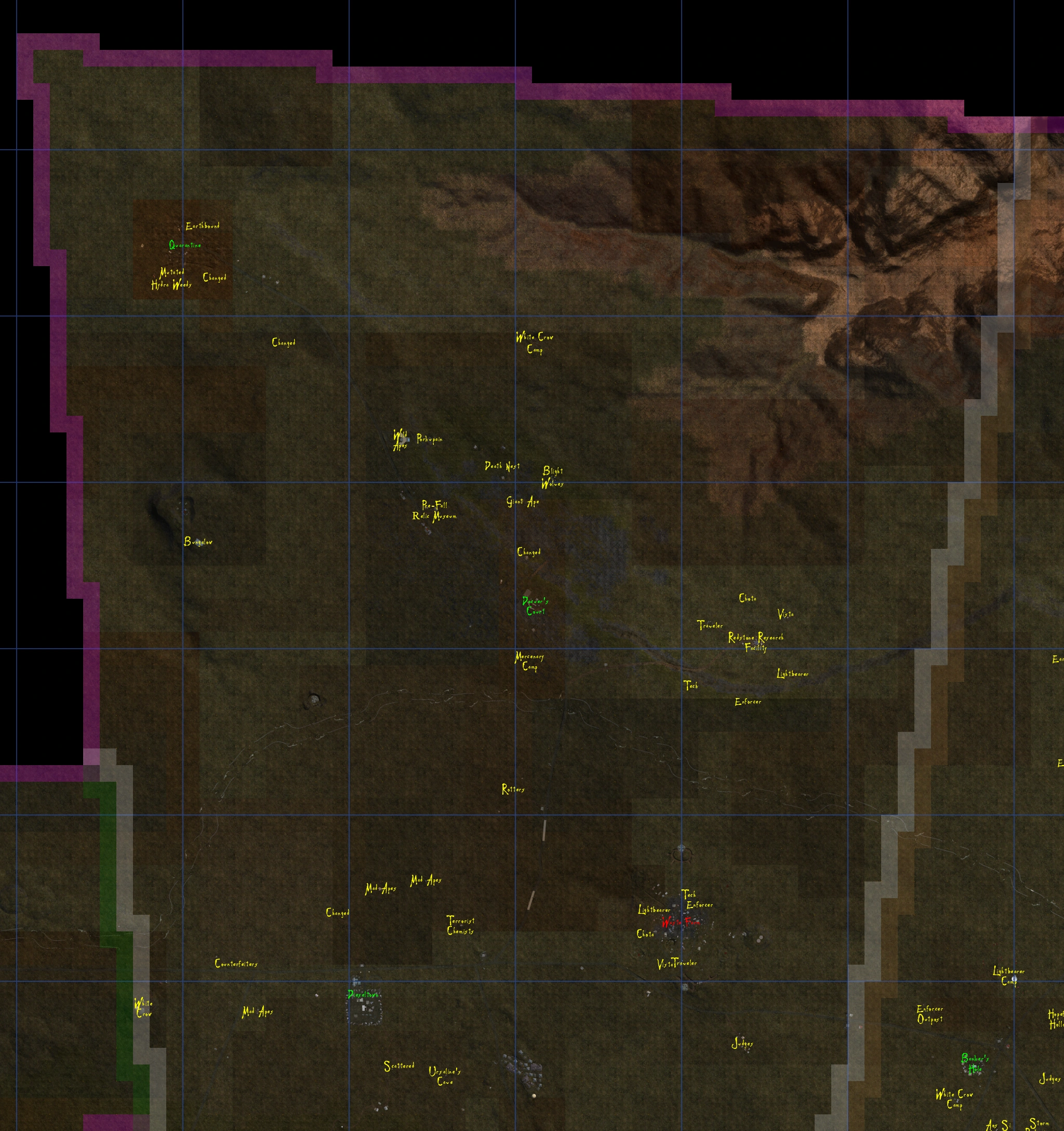
Kaibab Forest - Sector 3[]
- In-World Map
Central Kaibab[]
Northern Forest[]
- County Map (northern part)
- County Map (southern part)
Pine Valley[]
Timberland[]
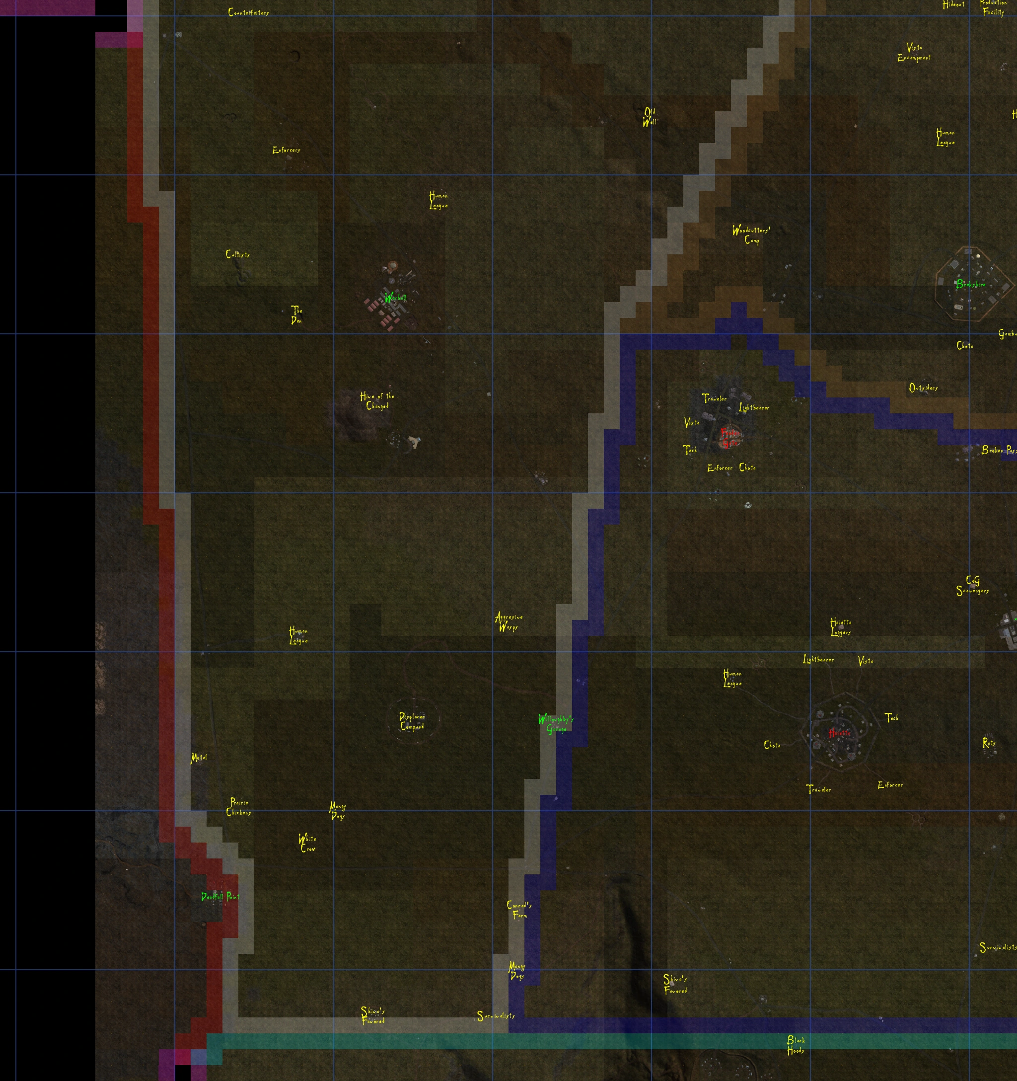
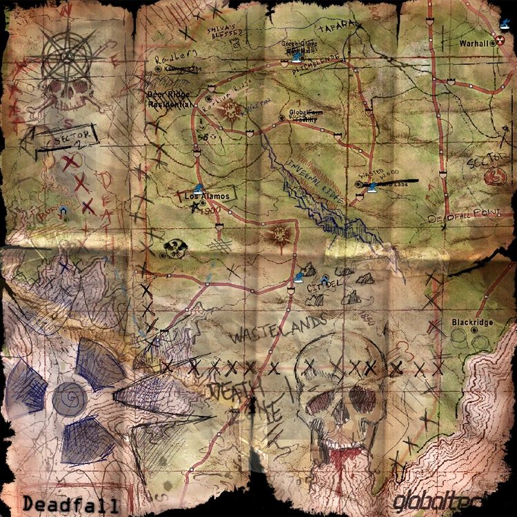
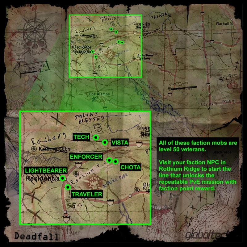
Deadfall[]
- In-World Map
- Overhead Map
- Faction Map

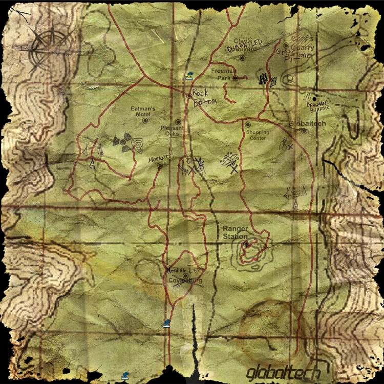
Terminal Woods[]
- In-World Map
- Overhead Map
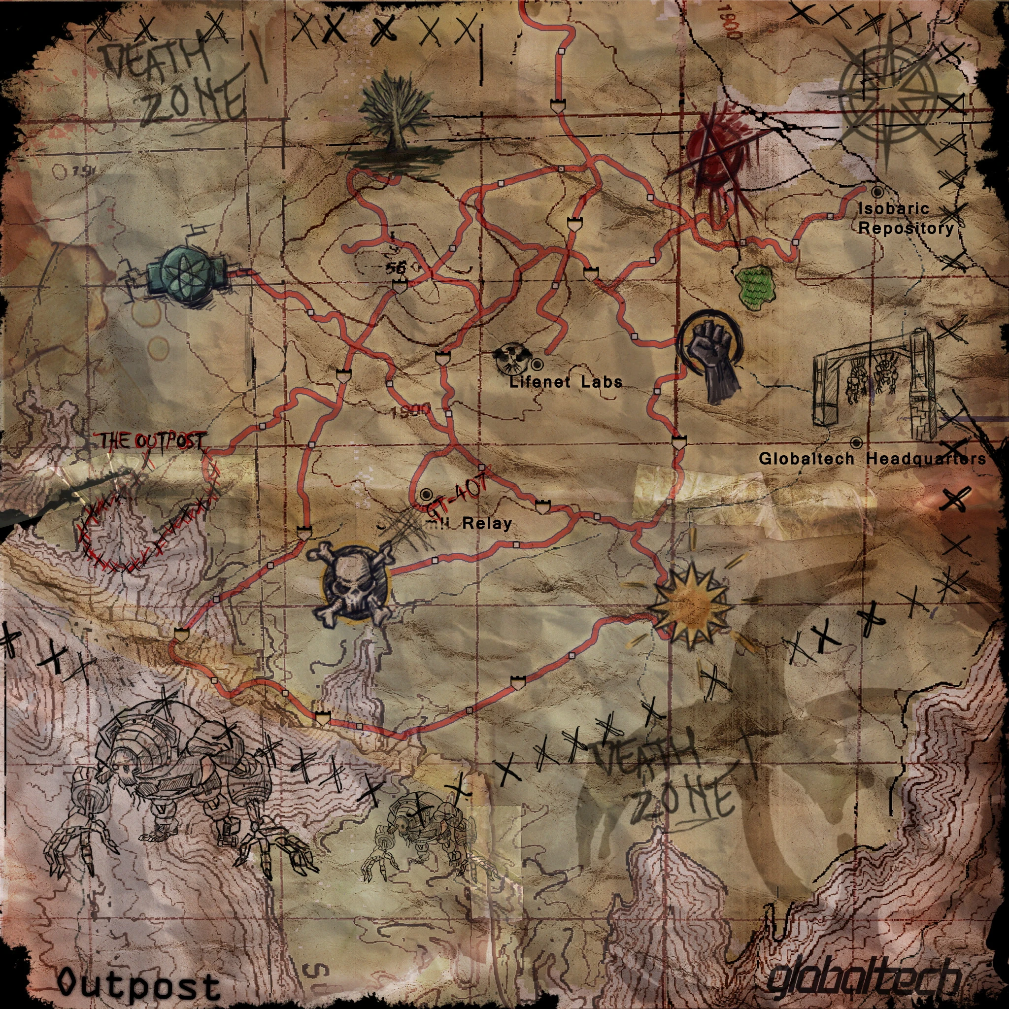
Alpha County - Sector 4[]
- In-World Map
- Overhead Map
Epsilon Zone[]
- In-World Map
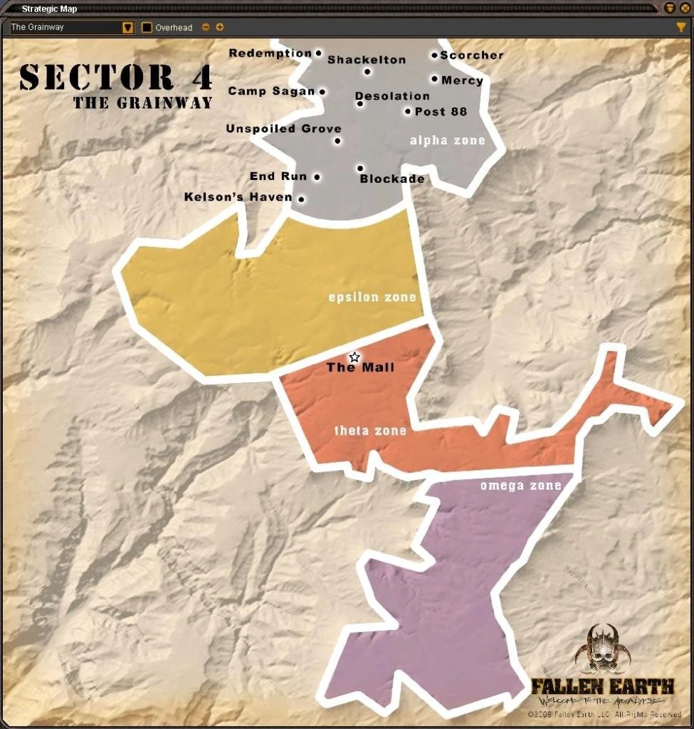
The Grainway[]
- Old design of the entire Sector 4
Trending pages

All items (62)


B
-
File:Banker's Run Rally Map.png

-
File:BankersHole Satellite.jpg

-
File:BarretManor Satellite.jpg

-
File:BarrowsExchange Satellite.jpg

-
File:Bergman's Burrow Map.jpg

-
File:Blackhill Satellite.jpg

-
File:Blaine Satellite.jpg

-
File:Boneclaw Satellite.jpg

-
File:Brekshire Satellite.jpg

-
File:BriggsPoint Satellite.jpg

-
File:Buxton Satellite.jpg


C


M
-
File:Map Alpha County.jpg

-
File:Map Deadfall.jpg

-
File:Map Kaibab Forest.jpg

-
File:Map Northfields.jpg

-
File:Map of the Devil's Own Fortress.jpg

-
File:Map of the Well.jpg

-
File:Map Plateau.jpg

-
File:Map Terminal Woods.jpg

-
File:Map-Shiva's Favored Mine Camp.jpg

-
File:Methane Plant Map Part II.jpg

-
File:Methane Plant Map.jpg

-
File:Murderhole Satellite.jpg


S


T


